Tell Angle how far you want to go. Its Curve Intelligence automatically stitches together the twistiest roads near you from real riders' lean-angle data. Guided turn-by-turn with 100% offline GPS navigation.
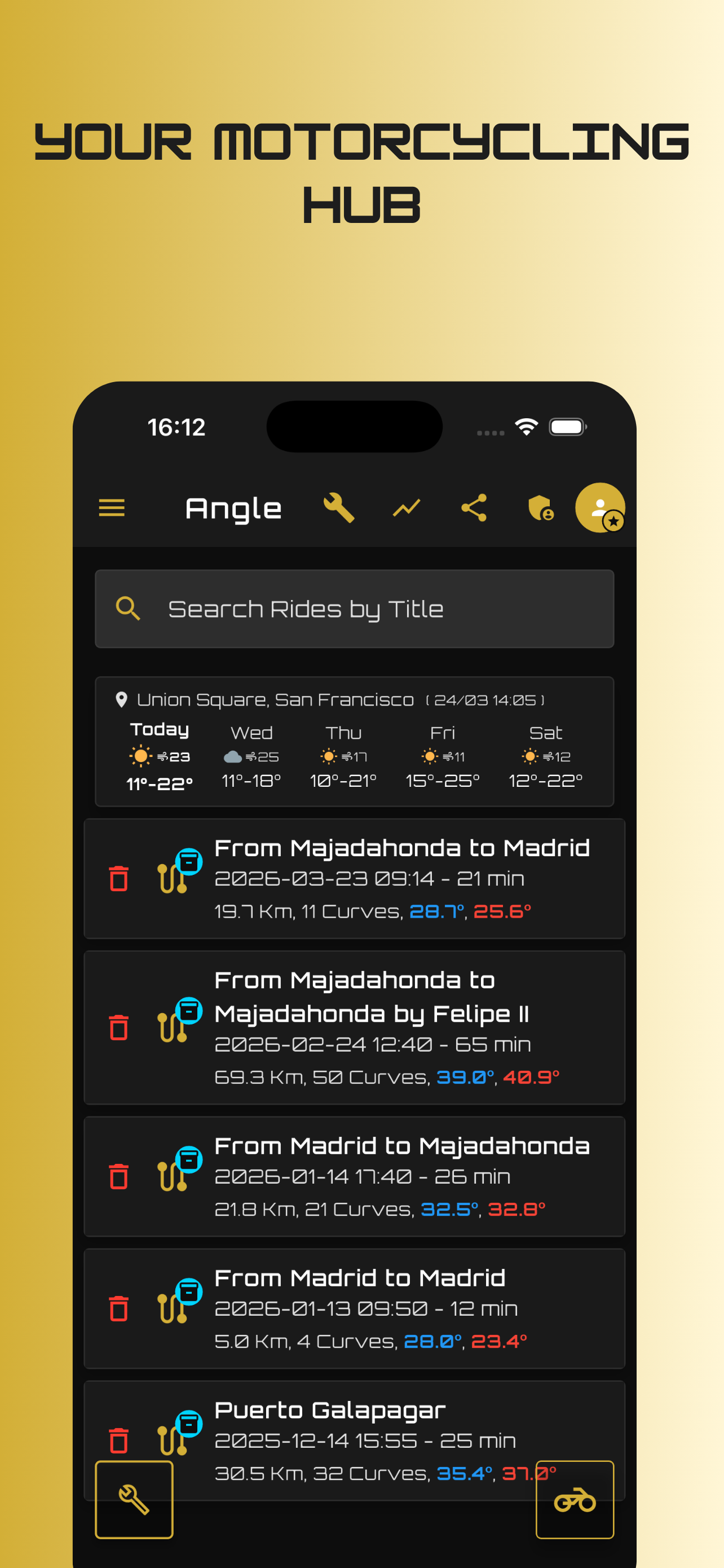
Designed from the ground up for motorbikes, track days, mountain passes, and touring weeks.
Tell Angle how many kilometers you want to ride, and it builds the motorcycle route for you — automatically weaving together the twistiest roads nearby from real rider lean data no other app has.
Navigate to any destination with full voice guidance — no data, no cellular signal, no problem. Designed specifically for riders wearing helmets, with uncluttered high-contrast visuals.
Never plan a fuel stop from memory again. Angle scans your route corridor and overlays petrol stations, rider cafes, bike repair shops, and breathtaking lookout points directly onto your track.
No expensive sensors, no wiring, no calibration headaches. Angle uses your phone's built-in IMU and precision GPS.
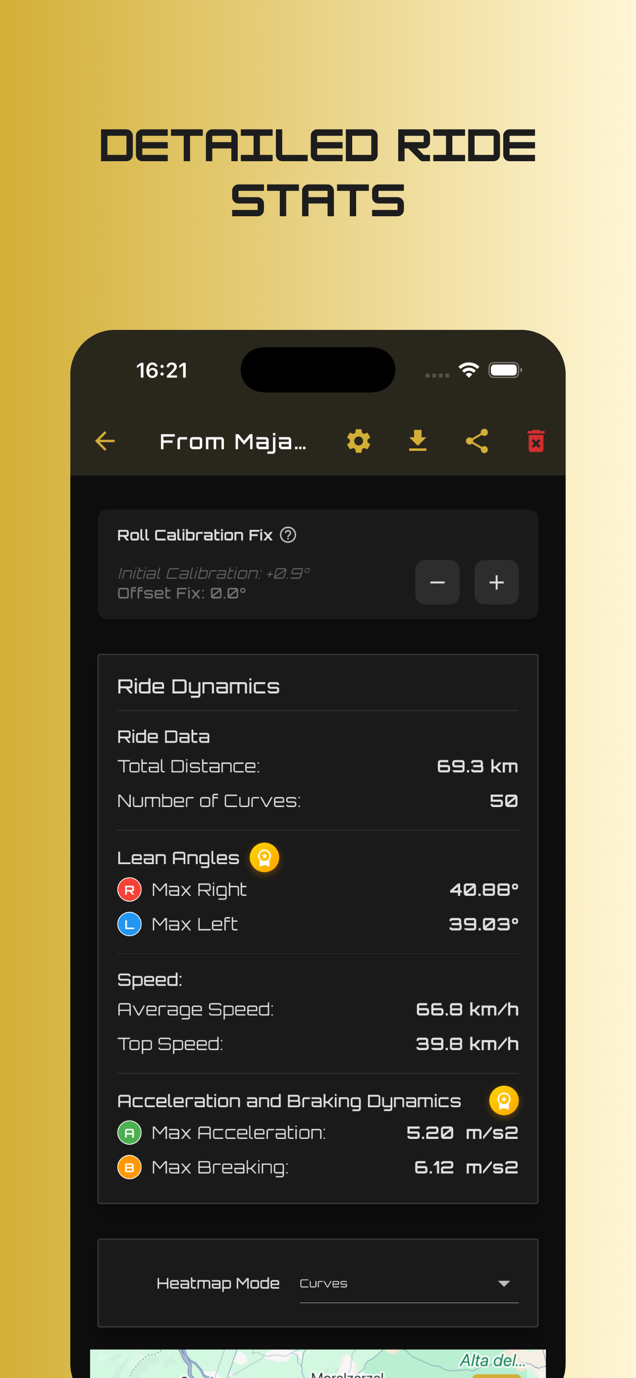
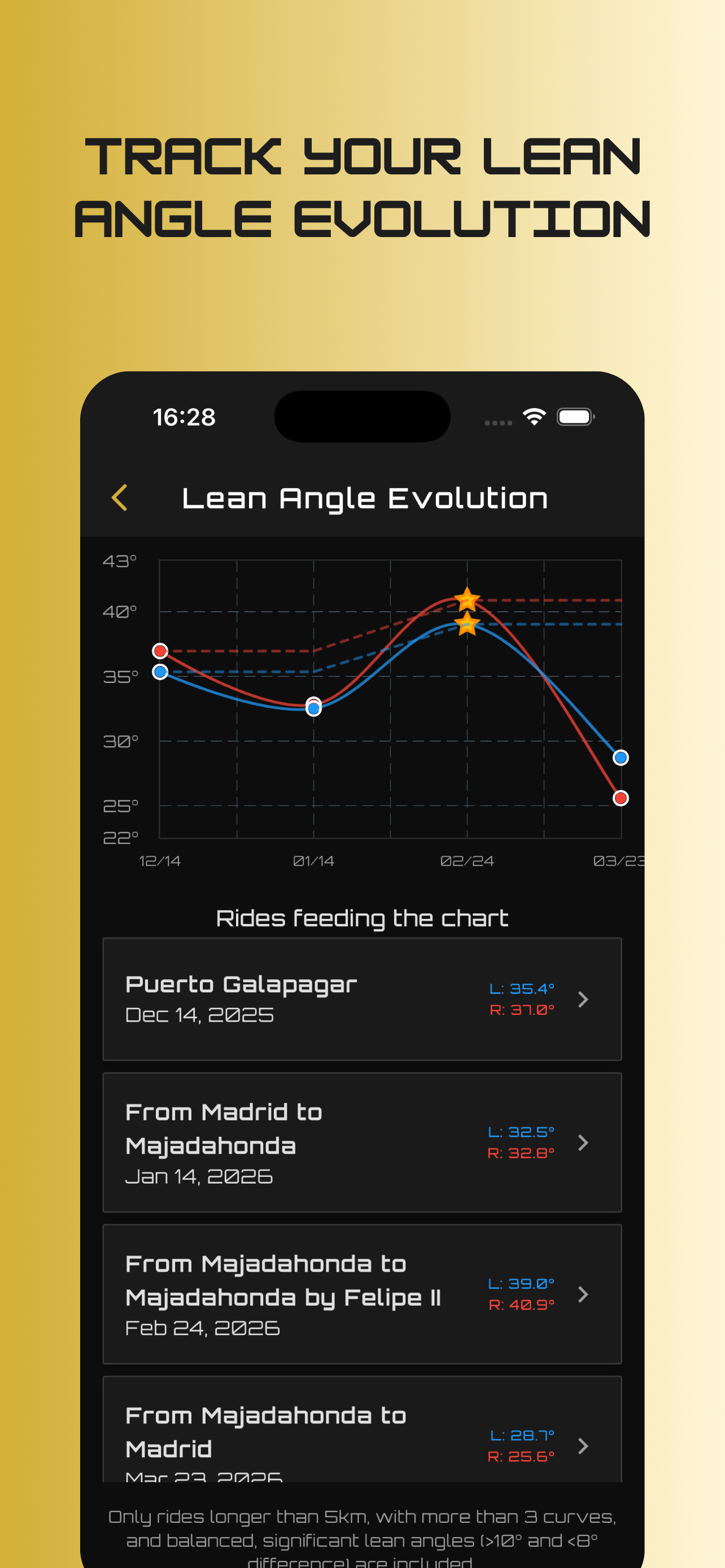
Measure your exact left and right lean angle in real-time, down to the degree. Know exactly how deep you banked on every sweeper and hairpin.
No handlebar mount? No vibration damper? Just slip your phone into your jacket pocket. Angle auto-calibrates once you're rolling and records hands-free.
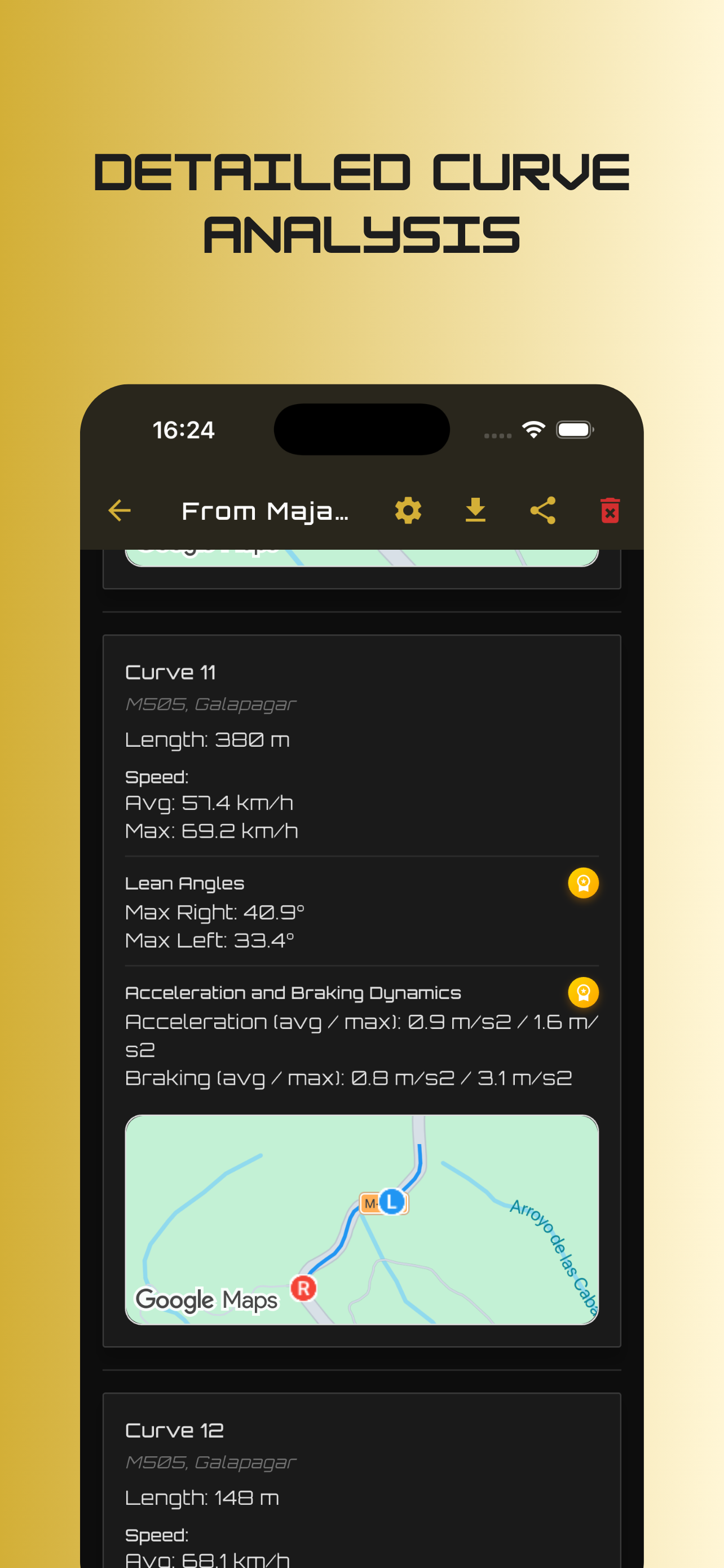
Capture peak braking force (m/s²) and longitudinal G-forces. Automatic curve detection scores entry speed, apex lean, and exit acceleration for every bend.
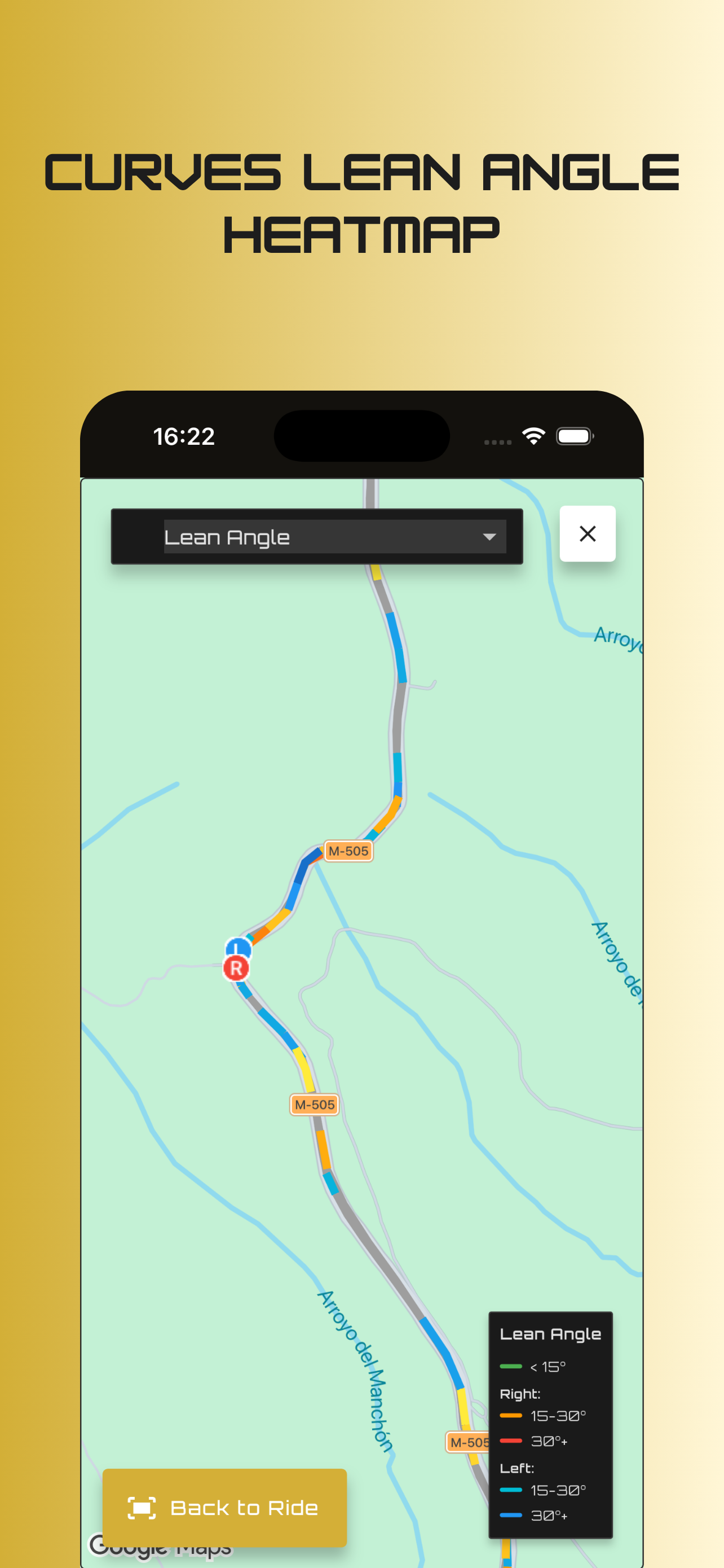
Color-coded trajectory maps highlight heavy braking zones, lean intensity, and speed sectors. Compare the same mountain pass week after week.
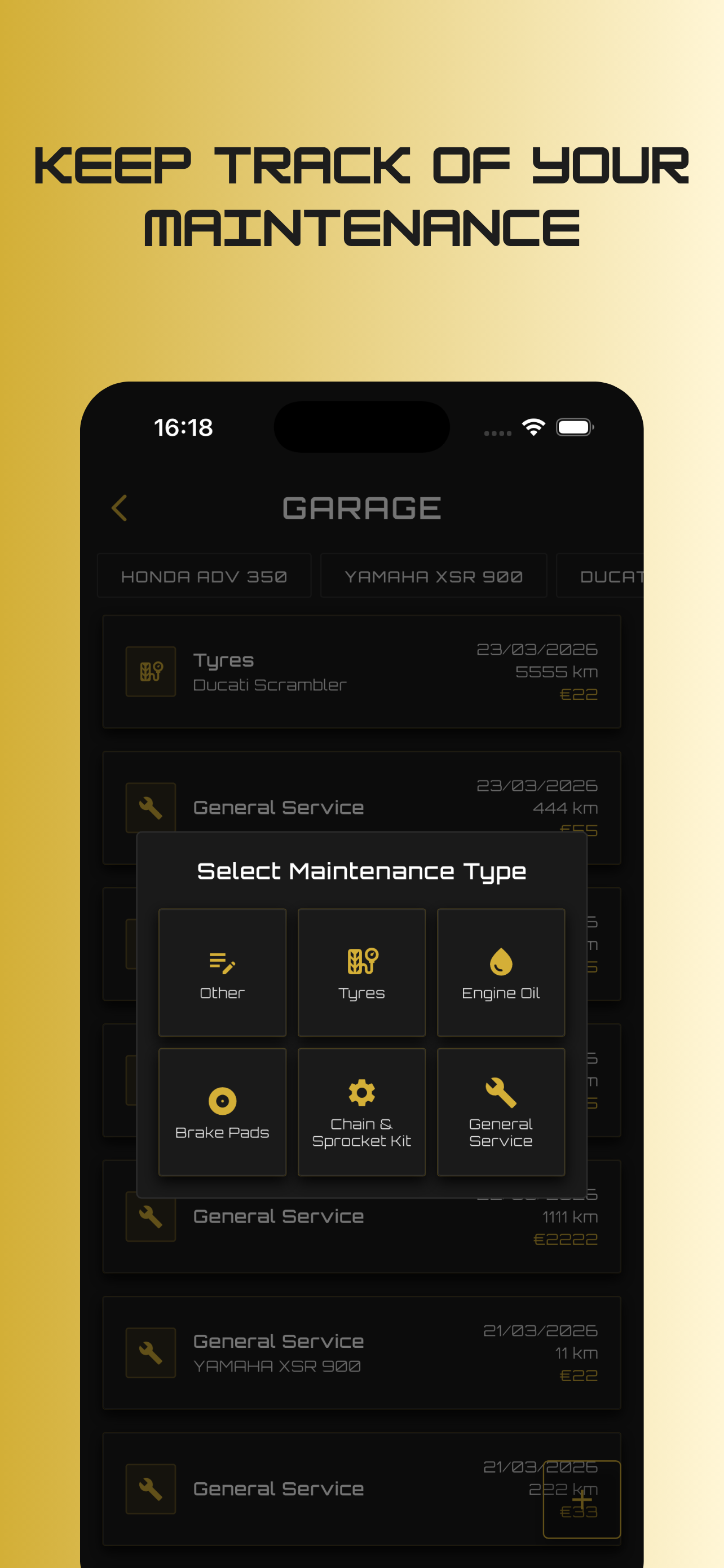
Maintain full service logs for all your bikes — tyres, oil changes, brake pads, chain tension, and sprockets. Track expenses and upcoming maintenance intervals.
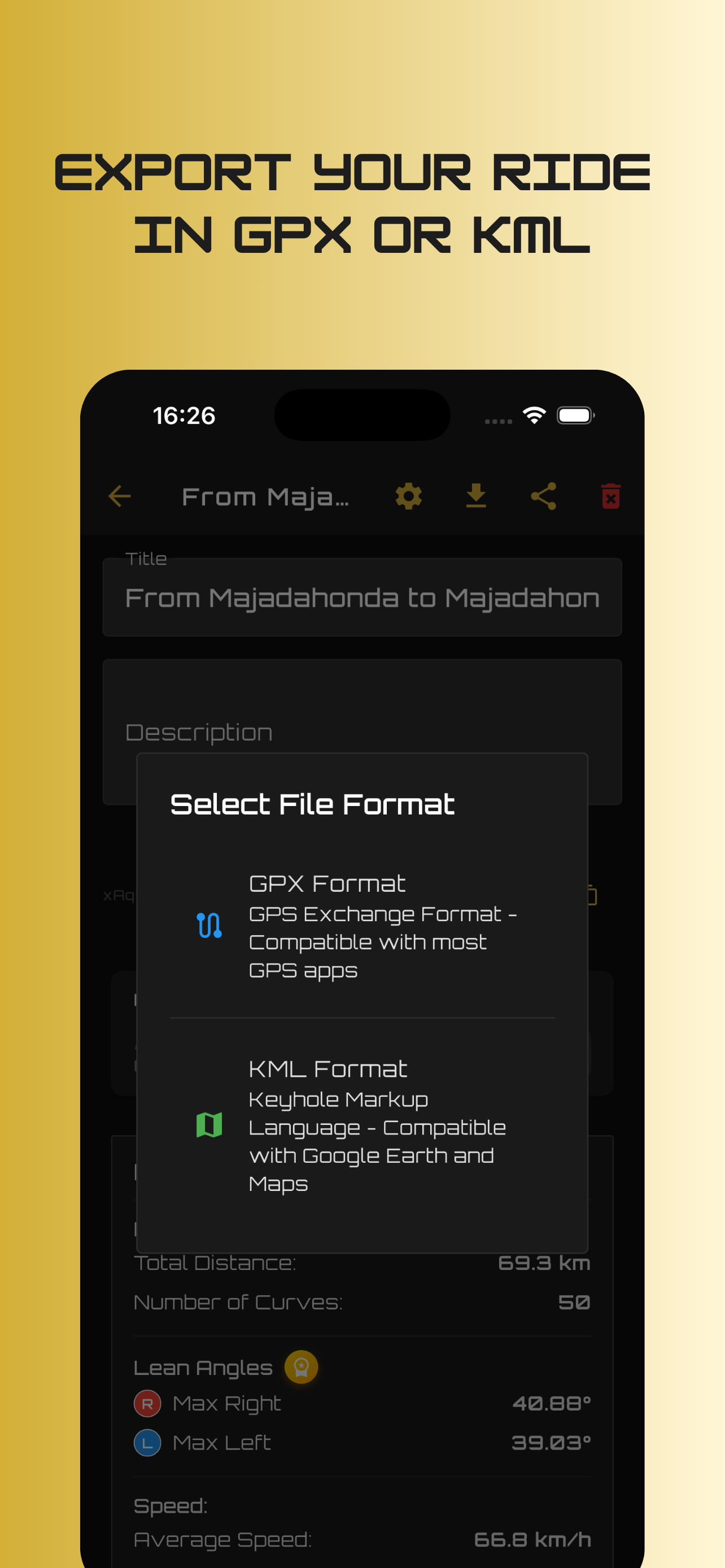
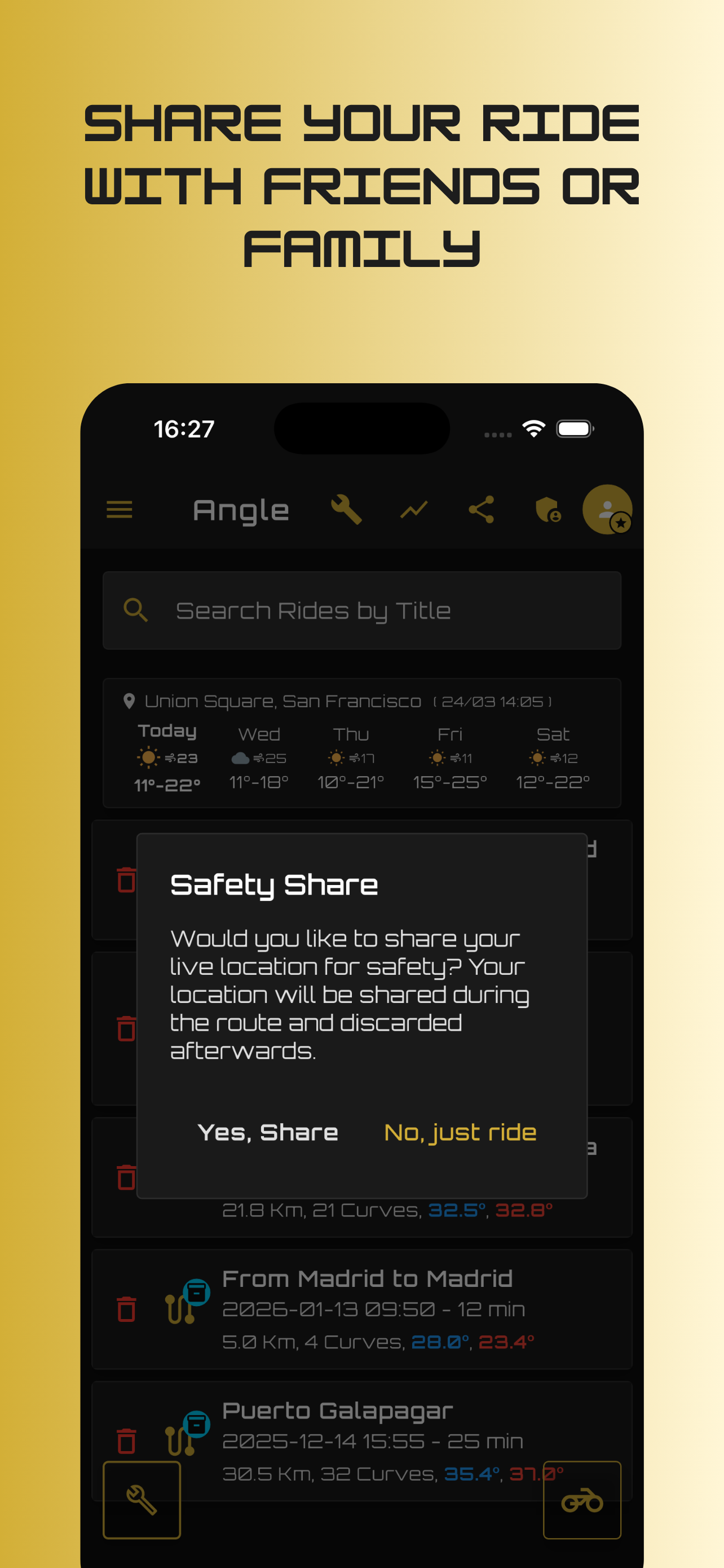
Share a secure live link so loved ones can track your ride position in real-time. Export complete ride telemetry to GPX or KML for GoPro and Insta360 video overlays.
Scroll through the screens to see Angle's purpose-built interface in action.
Not at all! With Angle's proprietary Pocket Mode, you can simply slip your phone into an inner jacket pocket. Once you start rolling, Angle's orientation algorithm automatically calibrates your motorcycle's vertical axis and records your true lean angles and braking data.
Yes! With Angle Premium, offline turn-by-turn navigation is completely autonomous. You can download maps and routes beforehand, and Angle guides you with crisp voice prompts and route recalculation even deep in mountain passes with zero cellular signal.
Yes! You can export any ride with high-resolution coordinates, waypoint stops, and telemetry data as GPX or KML files. These work seamlessly with telemetry video overlays (such as Garmin VIRB Edit, Telemetry Overlay, or GoPro GPS gauges).
Angle generates a secure, private tracking link that you can share with your family or friends. They can open it in any web browser to see your live progress, battery level, and pause state on a map. Tracking automatically stops as soon as your ride ends.